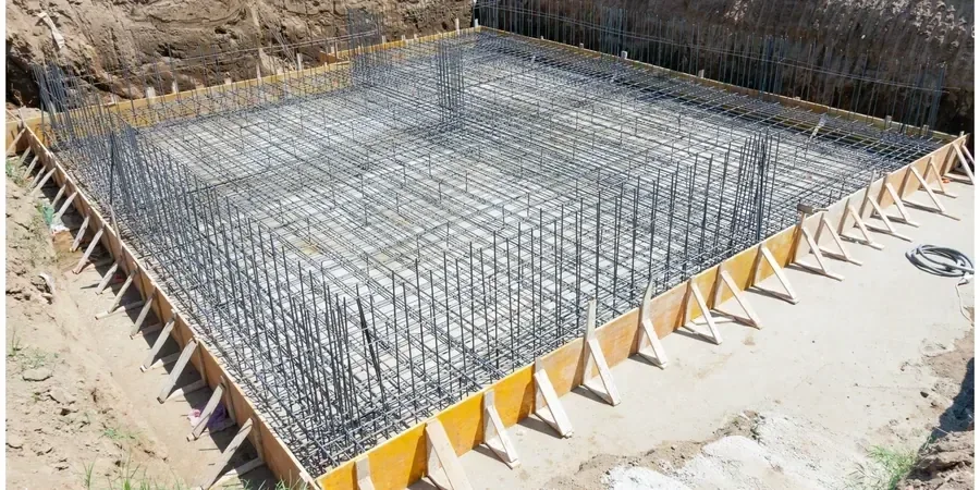
A laser level and a total station are the first tools out of the truck when we lay out a raft foundation in Christchurch. Precision matters more here than almost anywhere else in New Zealand. The flat Canterbury Plains hide a complex subsurface of alluvial gravels, sands, and silts, and the 2010–2011 earthquakes exposed just how variable the near-surface soils can be. Our team has designed mat foundations for residential rebuilds in the Residential Red Zone fringe and for commercial blocks near the CBD, where groundwater sits barely a metre below the surface. The challenge is always the same: creating a rigid, reinforced slab that can span across localised settlement pockets without cracking. For deeper stratigraphic control, we often combine the raft design with CPT testing because the cone data gives us a continuous profile of the interbedded sands and silts that standard borehole logs can miss in this fluvial environment.
In Christchurch's TC3 land, a raft foundation is not a slab; it is a reinforced concrete hull designed to float on soils that can lose half their bearing capacity during a seismic event.